Mendocino County Sea Level Rise Roadway Impact Study
The Mendocino Council of Governments (MCOG) has launched the Sea Level Rise Roadway Impact Study (the study) to identify and prioritize Mendocino County and city-managed coastal roads throughout Mendocino County that are most vulnerable to sea level rise. Flooding, erosion, and storm surge are already affecting many low-lying roads and bridges, with impacts expected to worsen as the climate changes. This study is a crucial first step in planning potential roadway adaptation strategies, addressing Mendocino’s most pressing climate-related transportation challenges, and helping to protect our coastal communities by ensuring safe, reliable transportation access now and into the future.
Using grant funding from Caltrans, the study will evaluate a thorough list of potentially at-risk roadways and narrow them down to five key locations for focused planning analysis. These sites will be selected based on climate vulnerability, engineering feasibility, community impact, and other factors. Please keep in mind that while the study cannot address all potentially at-risk sites, it will lay the groundwork for future planning and funding opportunities in the most urgent areas.
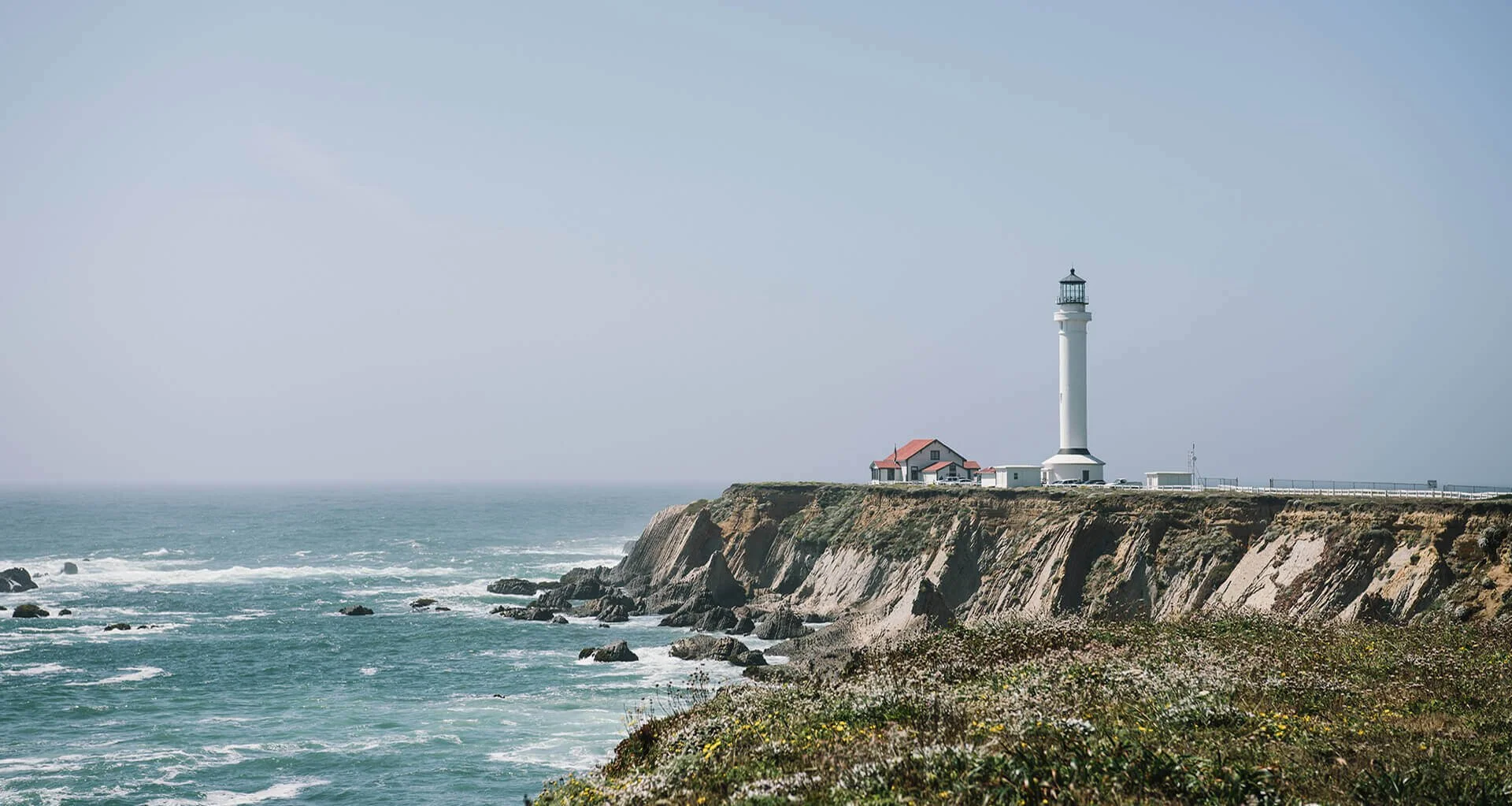
Point Cabrillo Drive, County Road 564, partially closed due to cliff erosion .
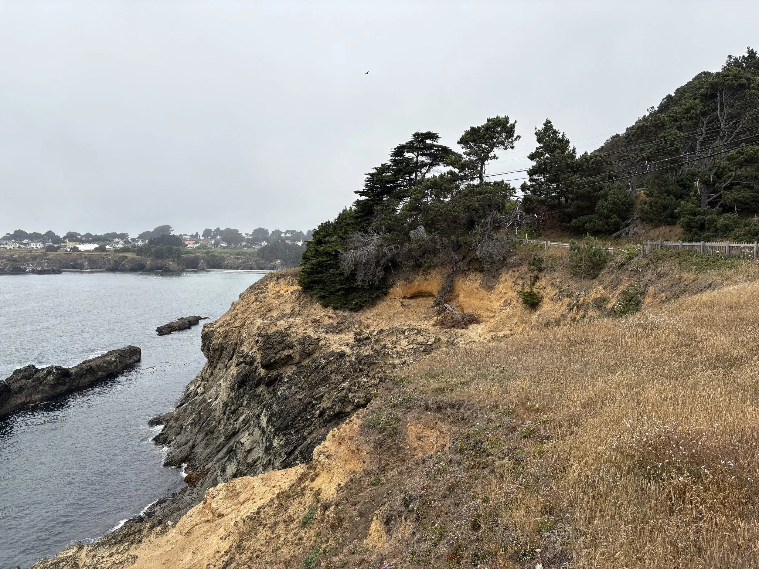
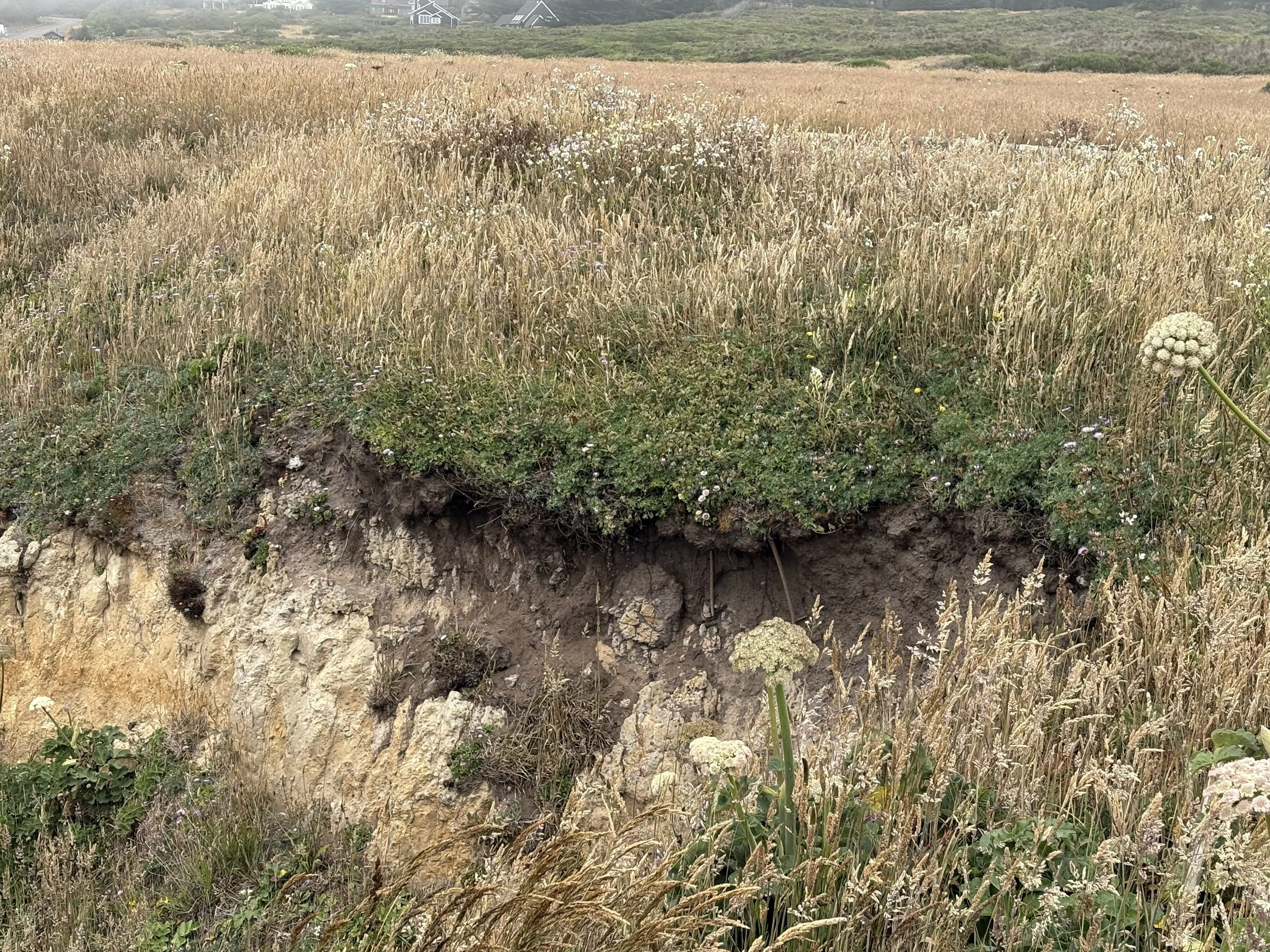
Old Coast Highway in Gualala, at risk of being impacted by cliff erosion .
We are in the early stages of this project. Check back here often for project updates and opportunities for community involvement.
You can also Contact Us to sign up for email updates to follow the project’s progress and participate in upcoming outreach events.
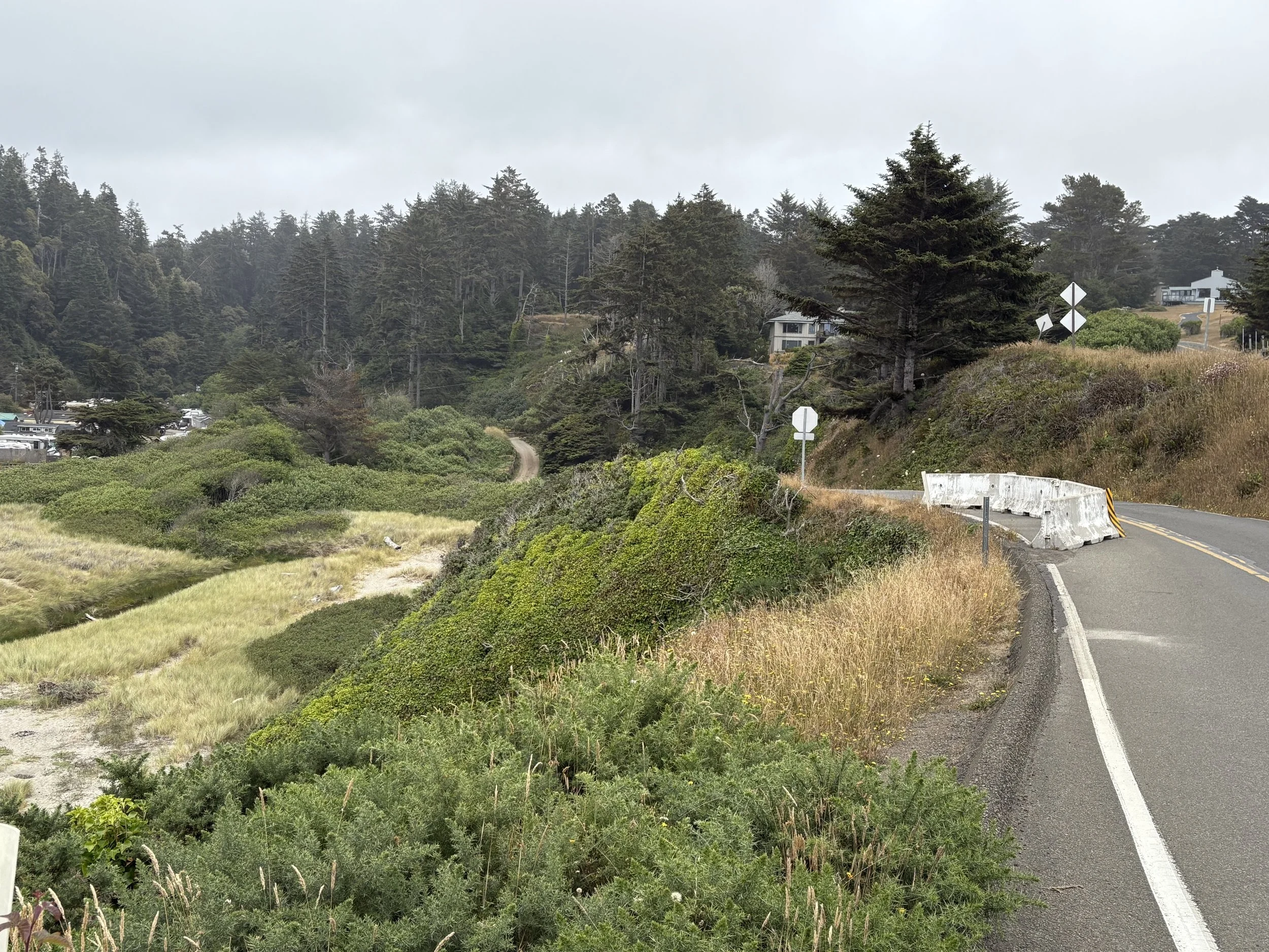
Left: Brewery Gulch Road in the City of Mendocino
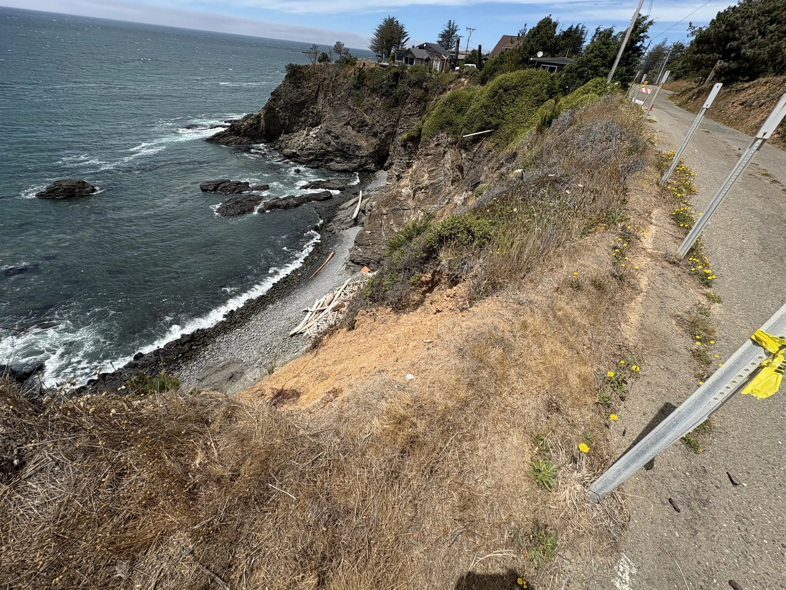
Right: Close-up of cliff erosion occurring near Heeser Drive in the City of Mendocino
After selecting the top five locations, the project team will explore adaptation options to account for the current and future effects of climate change, with the goal of preventing or minimizing harm. Adaptation options may include elevating or realigning roads, improving drainage, using natural shoreline buffers, or designing flood protection systems. In some areas, alternate routing or gradually moving buildings and roads to safer ground may also be considered. After developing adaptation options for each of the five selected locations, the study will evaluate the benefits, risks and feasibility of each option and recommend a preferred adaptation approach for that location.
Community input is a vital part of this process. Your feedback will help identify at-risk sites and guide strategies that reflect the needs of residents, businesses, and emergency services. If there is a road that you think would be a good candidate for evaluation, please email info@MendocinoSLRstudy.org. Please note that just because a road is recommended for consideration does not mean it will become one of the five sites selected for further analysis. However, it is still helpful for us to include as a possible site for future planning efforts.
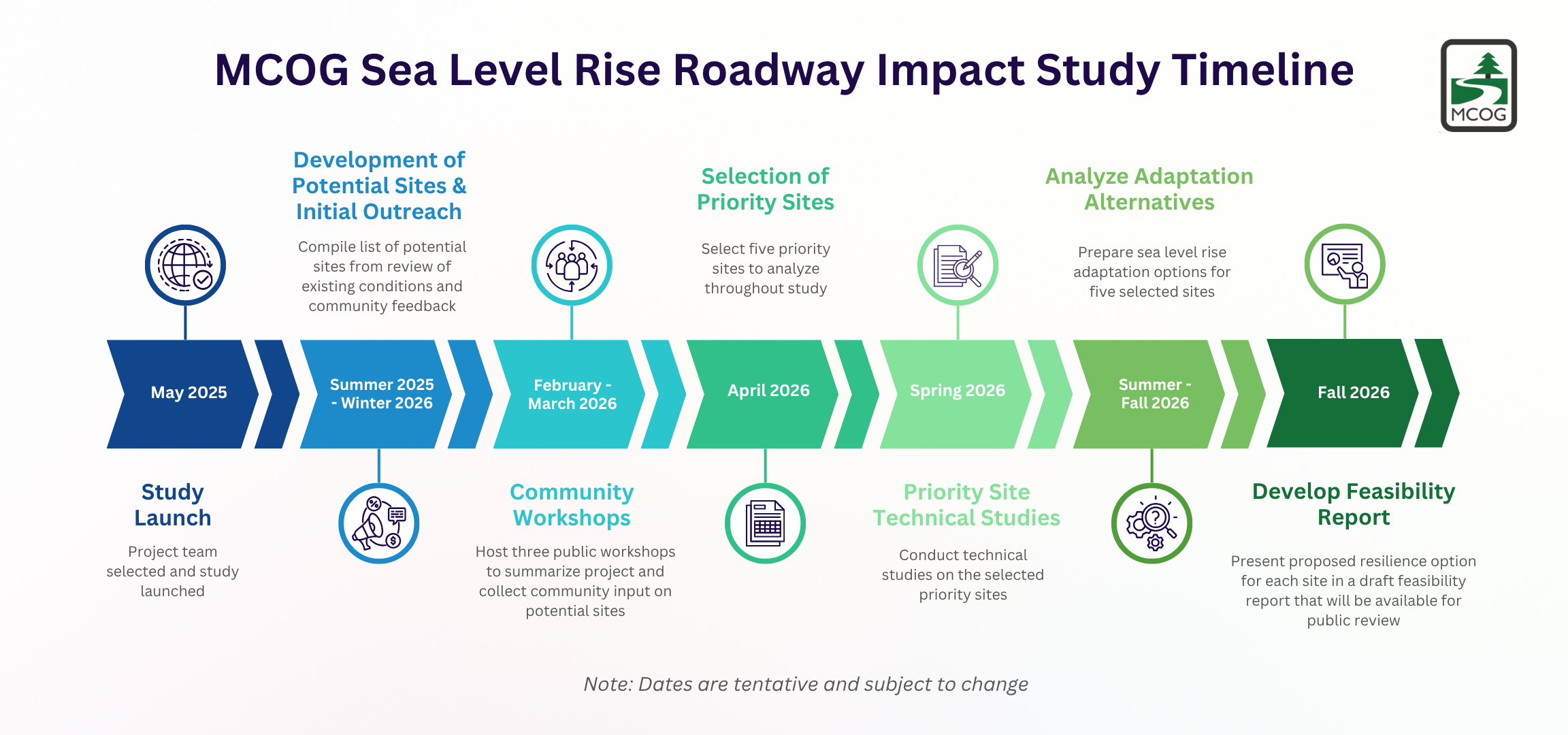
Timeline
The Sea Level Rise Roadway Impact Study was launched in May 2025. We expect to select the five sites to be included in the study by April 2026 and to complete the study in fall 2026. There will be opportunities for public input and engagement beginning in winter 2025.

This is an example of an adaptation option produced for another project – the adaptation options for the five selected sites presented in the final Feasibility Report will look similar.