Mendocino County
Sea Level Rise
Roadway Impact Study
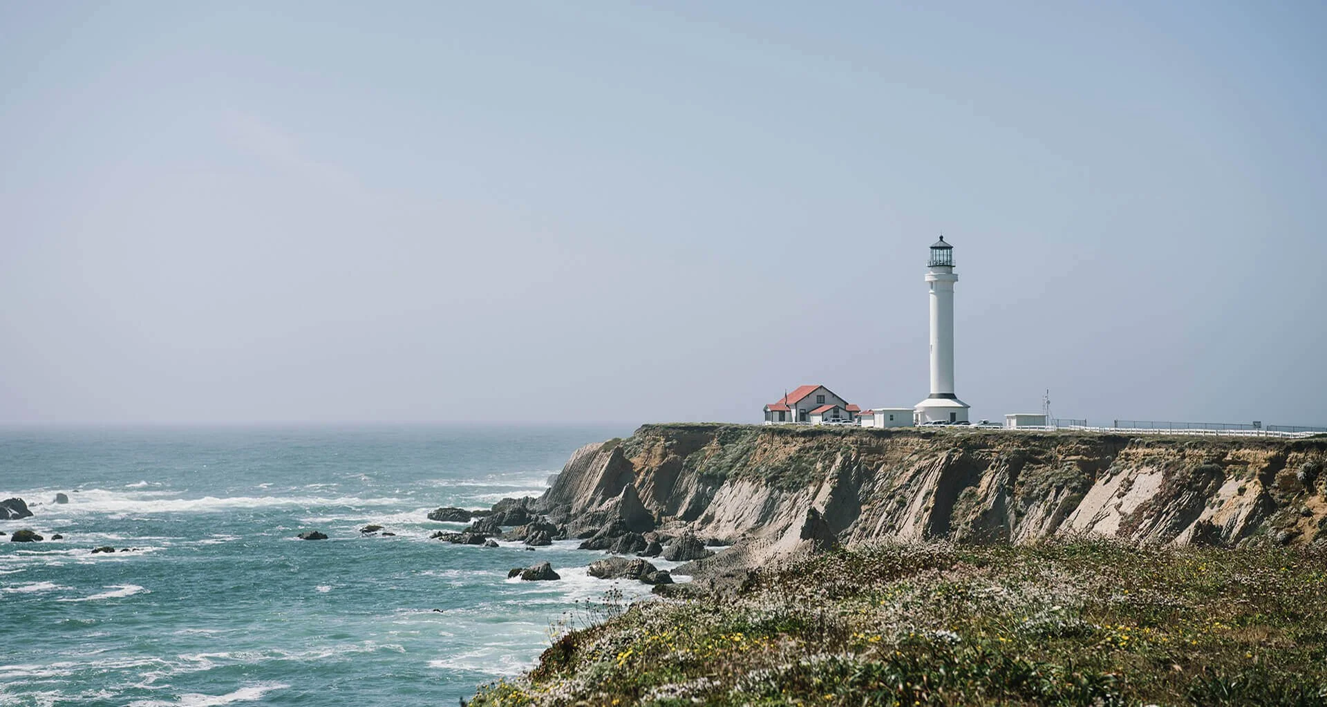
The Mendocino Council of Governments (MCOG) has launched the Sea Level Rise Roadway Impact Study (the study) to identify and prioritize Mendocino County and city-managed coastal roads throughout Mendocino County that are most vulnerable to sea level rise. Flooding, erosion, and storm surge are already affecting many low-lying roads and bridges, with impacts expected to worsen as the climate changes. This study is a crucial first step in planning potential roadway adaptation strategies, addressing Mendocino’s most pressing climate-related transportation challenges, and helping to protect our coastal communities by ensuring safe, reliable transportation access now and into the future.
Using Sustainable Transportation Planning Grant (STPG) funding from Caltrans, MCOG identified 23 potentially at-risk roadway segments, including three locations that were added into the study based on community feedback. These roadway segments were evaluated to determine which five segments would move forward with focused planning analysis. Criteria used in the evaluation included roadway use, the consequences of roadway failure, vulnerability to sea level rise and other climate impacts, potential adaptation approaches, implementation feasibility, and community feedback.
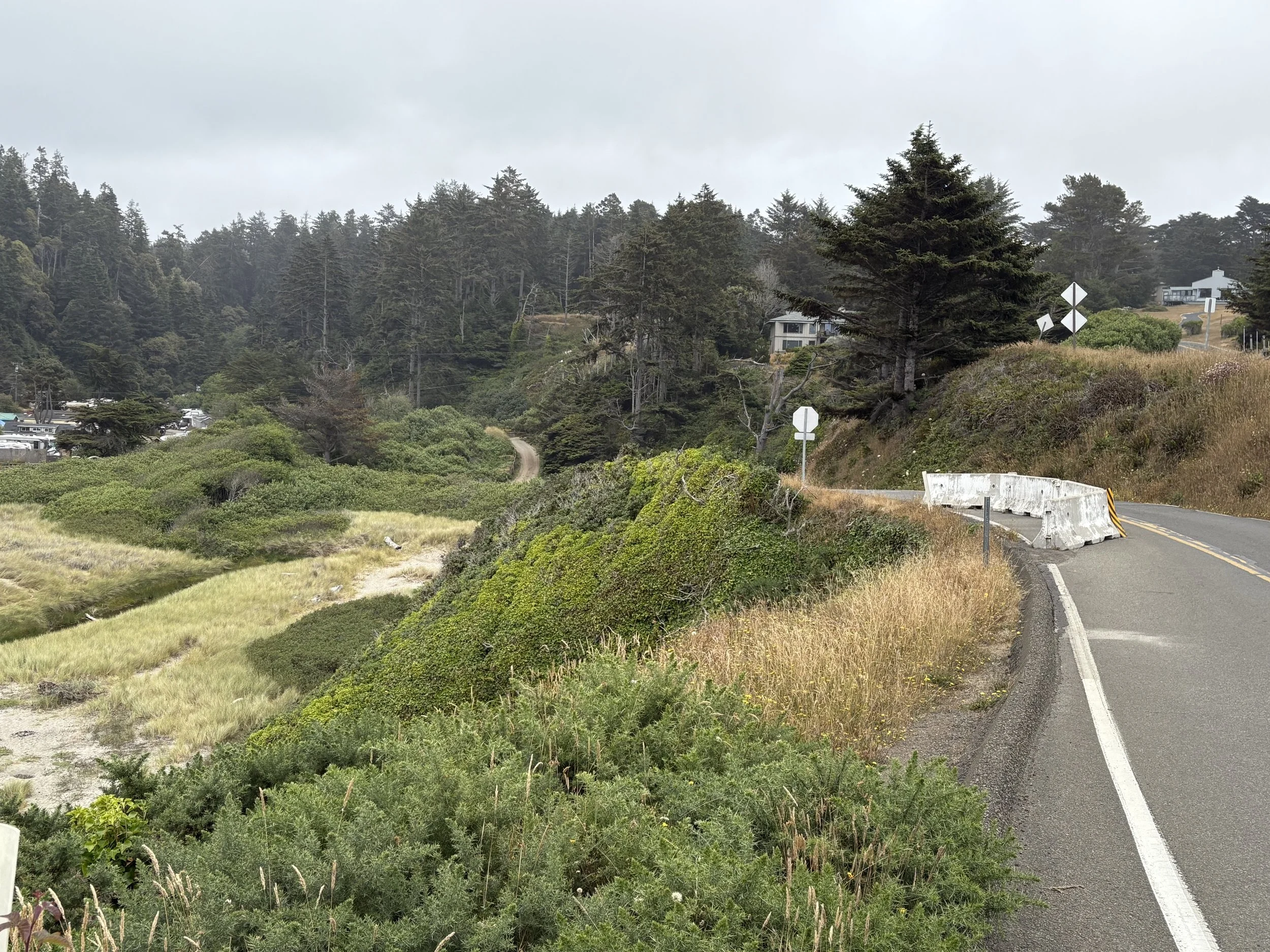
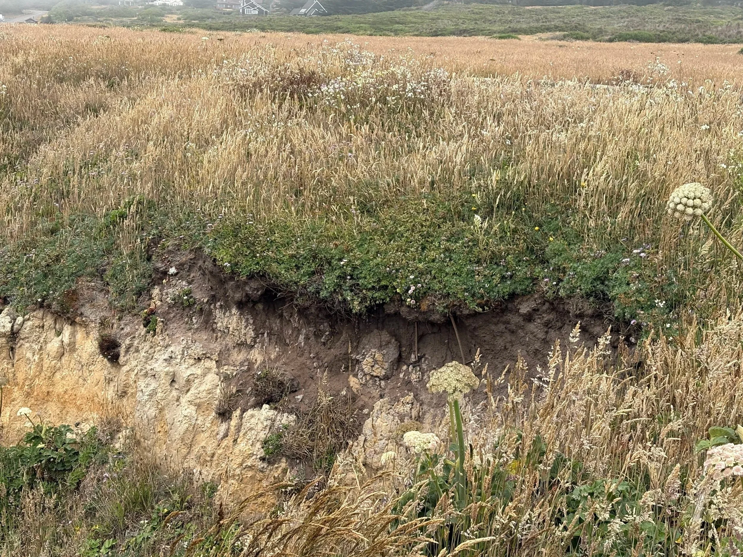
Point Cabrillo Drive, partially closed due to cliff erosion .
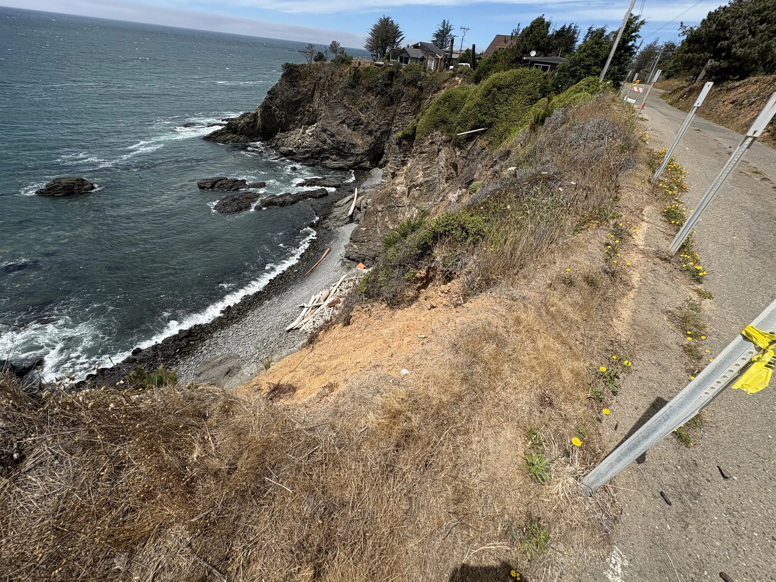
Old Coast Highway in Gualala, at risk of being impacted by cliff erosion .
Based on the study's evaluation process, including community input, the following five locations have been selected for further study:
· Point Cabrillo Drive in Caspar (google maps link)
· Old Coast Highway in Gualala (google maps link)
· Port Road “East” in Point Arena, along the extent that periodically floods (google maps link)
· Lighthouse Road in Point Arena (google maps link)
· Ocean View Drive (at Cliff Way) in Fort Bragg (google maps link)
Please keep in mind that while the study cannot address all potentially at-risk sites, it will lay the groundwork for future planning and funding opportunities in the most urgent areas.
The next phase of the study will focus on developing and evaluating adaptation options for each of the five selected locations. The project team will explore adaptation options to address current and future climate-related impacts at each of the five locations, with the goal of reducing risk and improving long-term roadway resilience. Potential adaptation measures may include roadway elevation or realignment, drainage improvements, shoreline protection features, alternate routing, or other strategies tailored to local conditions.
Once adaptation options have been developed, the study team will evaluate the benefits, risks, costs, and feasibility of each approach and identify a preferred adaptation strategy for each location. These findings will be documented in a Feasibility Study, which will be shared for public review. We anticipate the Feasibility Study will be released in Winter 2026. While no construction will occur as part of this study, the findings and preferred adaptation strategies will inform future planning and funding efforts.
While we work to evaluate adaptation options and prepare the Feasibility Study, we welcome you to Contact Us.
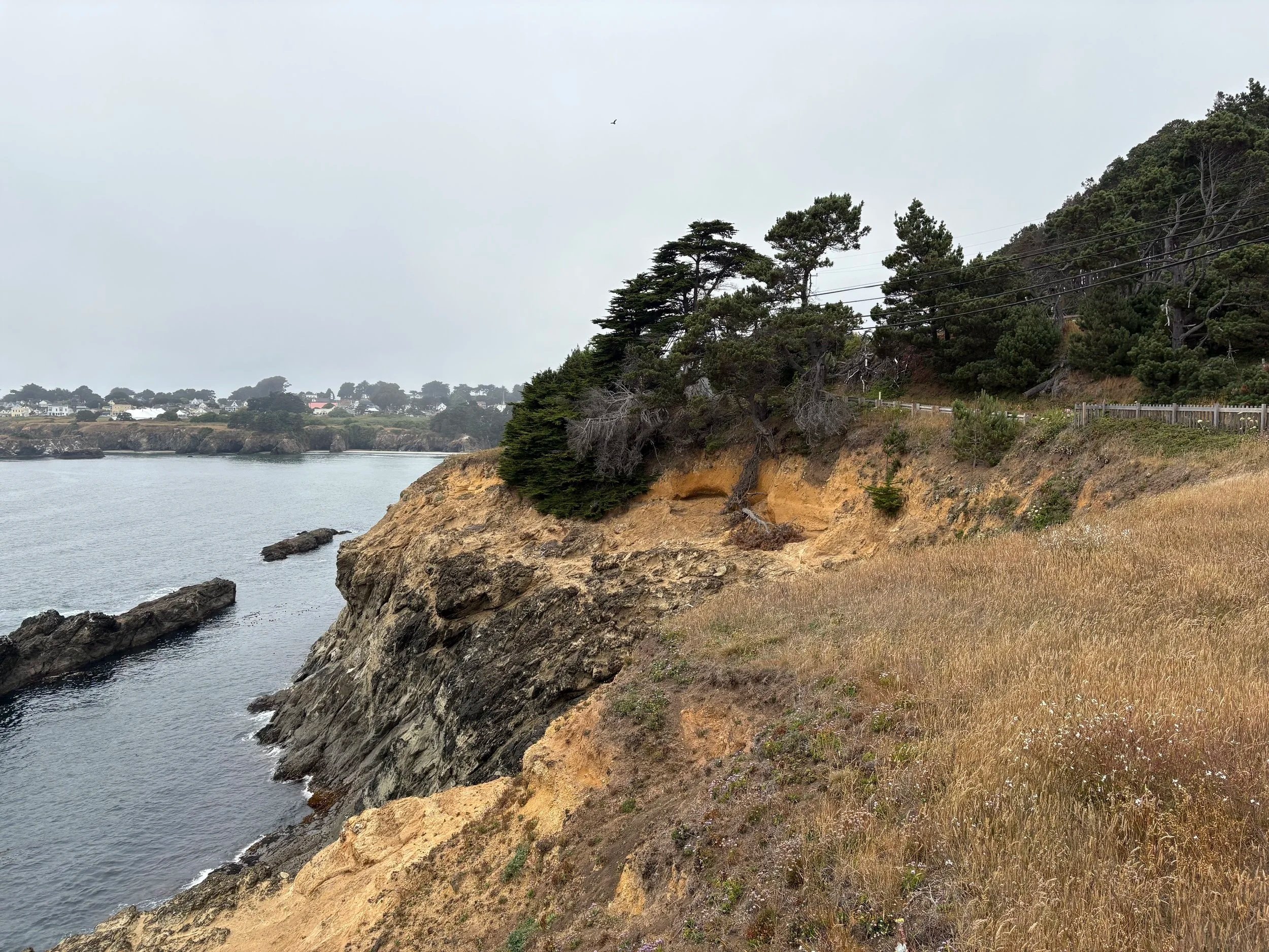
Left: Brewery Gulch Road in the City of Mendocino. Right: Close-up of cliff erosion occurring near Heeser Drive in the City of Mendocino
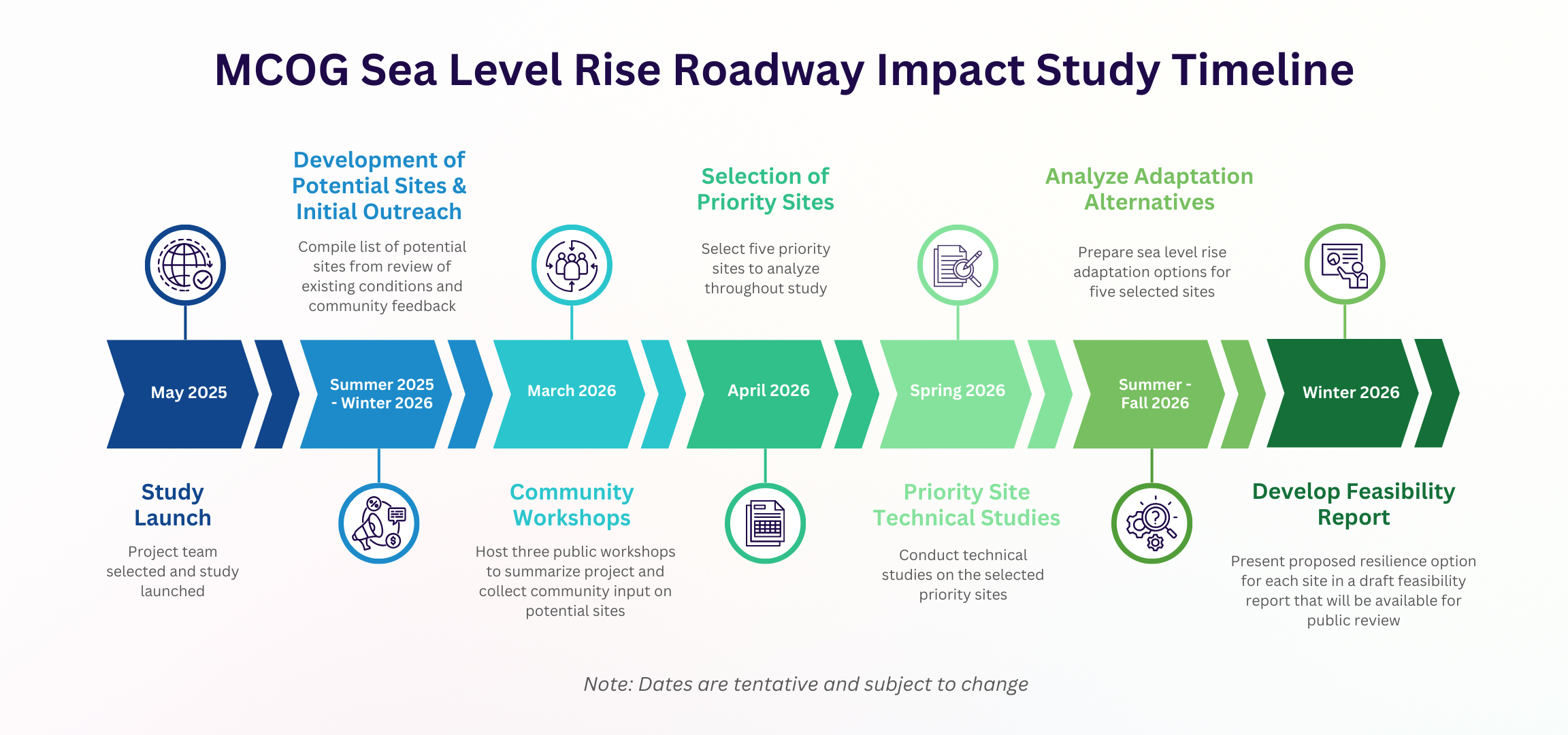
Timeline
The Sea Level Rise Roadway Impact Study was launched in May 2025. Following technical evaluation and community input, five priority locations were selected for further study in May 2026. The project team is currently developing and evaluating adaptation options for these locations. A Feasibility Study is anticipated to be released for public review in Winter 2026.

This is an example of an adaptation option produced for another project – the adaptation options for the five selected sites presented in the final Feasibility Report will look similar.